PHONE: 01451 830370 or 01451 831106
EMAIL: info@baggottantiques.com


Code: 9322
Dimensions:
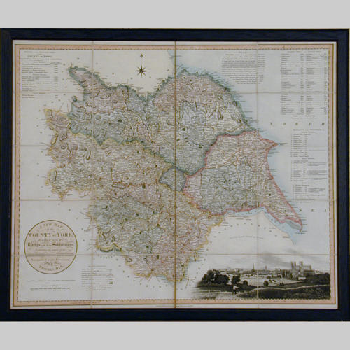
19th century map of the County of York. Surveyed by Thomas Dix, North Walsham. Published by William Darton, Holborn, London January 1820. Depicts Ridings and their Subdivisions, Navigable Canals and Rivers, etc. Folding Edition on linen with original carrying case. Now in a moulded, ebonised frame.